NATRX TECHNOLOGY OVERVIEW
Natrx Assess
Categorize coastal typologies, assess risks, identify opportunities for action, and measure the performance of implemented solutions. Natrx Assess enables landscape scale resilience planning with high definition across large areas and asset holdings.
Natrx Assess provides a never-before achievable view of land change dynamics. Using our proprietary remote sensing and intelligence platform, we deliver a high resolution understanding of your site that can predict likely erosion issues so you can address specific hotspots before they become a problem.
Natrx Assess Benefits:
Get started quickly without the need for time-consuming, less accurate field work
Reduce survey costs and planning timelines
Identify most vulnerable areas and assets with a high level of specificity
Anticipate rather than react to issues
Prioritize spend to maximize co-benefits
Measure vegetative health, erosion hotspots, biodiversity
Quantify financial and ecological benefits
Receive credit for enhancements and blue carbon
Natrx Assess can efficiently and cost-effectively analyze large-scale areas up to thousands of square miles with three meter precision. Our proprietary intelligence platform accurately identifies and categorizes your site’s specific physical characteristics and environmental conditions.
This high resolution analysis enables more accurate planning to address specific risks. Getting started is easy and cost-effective, it’s safer and more accurate than traditional field work, and the platform can be used for ongoing monitoring of the performance of risk mitigation actions.
Natrx Assess: Sample Output
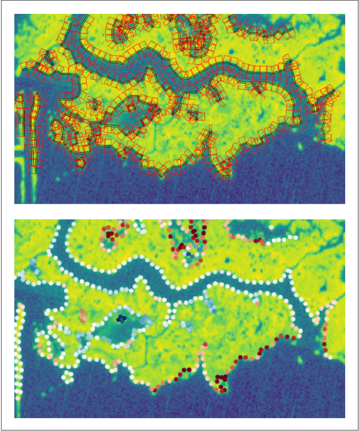
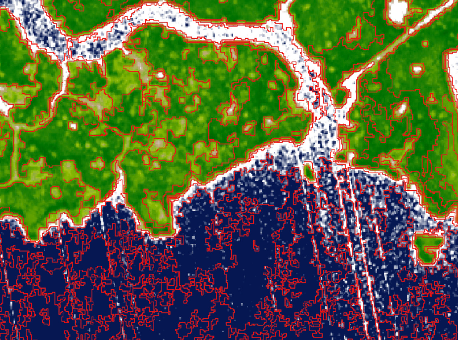
Erosion Analysis
Highly complex shoreline profiles can be analyzed using our methods to identify hot spots which are not apparent through manual analysis methods.
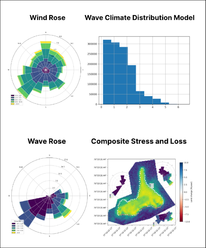
Shoreline Wave Climate Modeling
Modeling of fetch and wind driven wave distributions can be calculated in all directions. When combined with land loss and vegetation health analysis this provides rich and practical visual data for stakeholder engagement for resilience planning.
WHY NATRX ASSESS
Understanding land change dynamics is a fundamental element of landscape-scale resilience planning. Until now, actionable and practical data on coastal vegetation, erosion dynamics, and land loss risk has been lacking for resilience planning. The Natrx Assess geospatial platform can produce this evaluation quickly and accurately to supplement or even replace costly fieldwork.
With a Natrx Assess analysis you’re able to develop a plan to address specific problem areas before they become larger issues. Additionally, you’re able to continually monitor the performance of actions taken.
Reach out to get started with Natrx Assess
Get in touch to start an assessment of your erosion risks. The process is easy and cost-effective. You’ll also get an estimate of the benefits beyond potential erosion stabilization:
info@natrx.io
(919) 263-0667
PDF Download
Or use our contact form below.
Get Started with Natrx
Our process is designed to deliver high-performance resilience solutions in a wide range of habitats and locations. Each solution is custom and starts with a few simple questions. Get in touch and let's find the right solution to your challenge.


info@natrx.io (919) 263-0667 ©2024
6220 Angus Drive, Suite 101
Raleigh, NC 27617
Contact Natrx